| APT Archive |
NOAA 14 Image of the Eastern United States. Rivers in the Midwest were on the rise in this image, due to the snow-melt from the blizzard of the previous week. |
 |
|
|
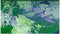
| NOAA 14 Image of the Central United States. This was one of my first false color images using WXSAT 2.3. It was acquired on 09/04/1997. |
 |
|
|
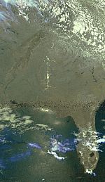
| This is a visible light image from NOAA 9, just before the satellite died. It shows and intense low pressure system spawnign severe weather over the Central United States. |
 |
|
|
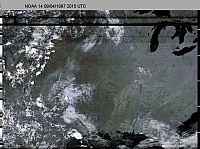
NOAA 14 Image of the Southeastern United States. Sun glint can be seen in the waters of the Gulf of Mexico and in the rivers in the Southeast U.S. Image was received from NOAA 14 on 06/07/1998 at 1946 UTC. |
 |
|
|
TR>
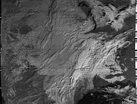
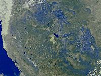
NOAA 15 Image of the Western United States. The Grand Canyon and Great Salt Lake are clearly visible in this image. This image was received on 07/12/1998 at 1531 UTC from NOAA 15. |
 |
|
|
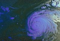
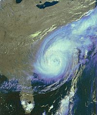
| Hurricane Bonnie |
NOAA 12 Image of the Hurricane Bonnie taking her aim on the Eastern U.S. This Image was received from NOAA 12 on 08/23/1998 at 1056 UTC. |
 |
|
|
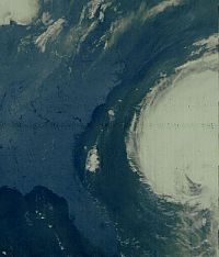
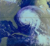
| NOAA 14 Image of the Eastern United States. Hurricane Bonnie is taking aim on the Eastern U.S. on 08/25/1998 at 0852 UTC. |
 |
|
|
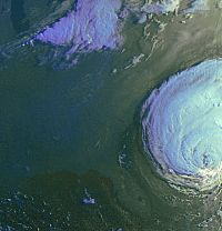
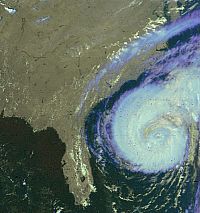
| Three hours later, NOAA 12 produced this image of Hurricane Bonnie. Image was received at 1159 UTC on 08/25/1998. |
 |
|
|
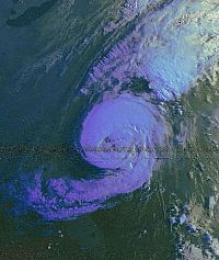
NOAA 15 produced this image of Bonnie at 1243 UTC on 08/25/1998. |
 |
|
|
TR>
NOAA 14 image of Bonnie on the afternoon of the 25 of August. Image was received from NOAA 14 at 2016 UTC. |
 |
|
|
NOAA 12 produced this image of Bonnie at 1137 UTC on 08/26/1998. |
 |
|
|
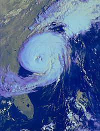
NOAA 15 produced this image of Bonnie making landfall at 1222 UTC on 08/26/1998. |
 |
|
|
NOAA 14 produced this image of Bonnie at 2005 UTC on 08/26/1998. |
 |
|
|


