This page is concerned with the quarry shown at location No.2 on the map on my 'Mining Introduction' page, and it can be found at ordnance Survey coordinates SX 849 867. It is located roughly South of Lake Farm in Doddiscombsleigh in a small area of woodland and is where me and my childhood friends used to spend a lot of time exploring as it was just three fields away from where I lived. It is reasonably close to the Teign Mine workings in Scanniclift Copse, and I'm guessing the two operations were most likely linked, with ore brought down from Scanniclift mines to be processed here, as it could have easily been transported across the hill to this site using an existing track, via Woodah Farm.

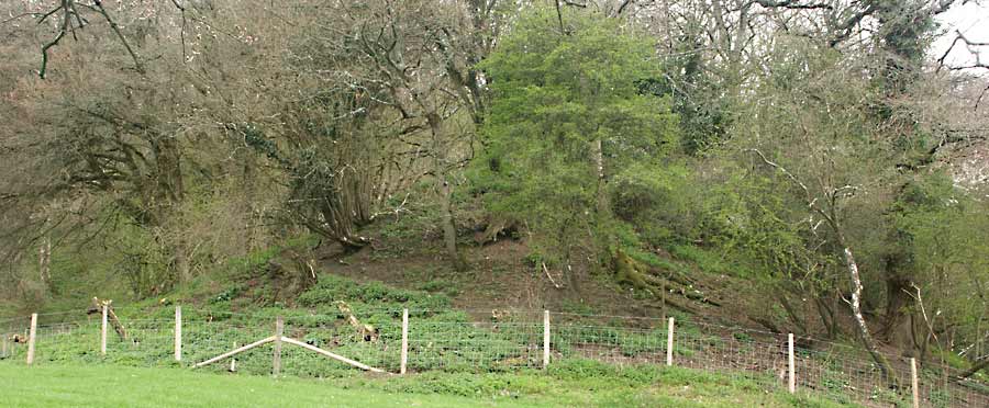
Photo 1
Looking across the main part of the quarry
This working appears to be mainly open cast in nature, and there now remains a large excavation with water filling the bottom, but there is possible evidence of shafts as well. The area is very overgrown, and there are many large oaks growing within the workings, some of which have fallen down exposing some of the geology as they did so, but many of the original features of the workings are still visible.

Photo 2
Possible ore dressing floor
Many years ago there was a feature which seemed to be an inclined plane leading out of the water-filled excavation at a constant angle which I had always imagined once carried rails for trolleys which presumably would have been winched up out of the quarry. A lot of material has unfortunately been removed from what was once the base of the incline in recent years, presumably to provide hard core for some building project elsewhere and the evidence for the inclined plane has now been largely destroyed, but I remember it well.
This incline led to a squared and levelled area shown in Photo 2, and in this photo it would have entered from the rear left. The incline emerged about 5 feet higher than the square excavated area, suggesting that trolleys coming up the incline ended up on an elevated floor built at that height above ground. I don't know why the system appeared to be constructed this way, but I have to assume that the area was used for ore dressing. From this area there is a level route which leads onto the extensive spoil heaps and back again into the quarry via another incline, forming an essentially circular route. The two main spoil heaps are large enough to be shown on Ordnance Survey maps.

Photo 3 |

Photo 4 |
Photo 3 & 4 look out onto the level top of the spoil heaps; photo 1 was taken from the same position as photo 2, just looking in the opposite direction, and photo 3 from further out onto the spoil heap. This area was particularly interesting to me as a kid, as at the right time of year it was covered by a healthy crop of butterbur plants, notable for their large leaves on long stems which could reach 4 - 5 feet in height; whether the colony still survives is currently unknown

Photo 5
Possible drainage sump
Photo 5 shows an odd feature just off to one side of the main pit, and although now in a rather overgrown and confused condition, it is still possible to see the high banks on three of the sides and of course the water at the bottom, the quarry being directly behind me. Once again, material has been moved about here in more recent times sadly destroying many of the original features, but when I was in my teens I distinctly remember this region actually consisting of two distinct rectangular depressions, one in the foreground and the other behind it divided by a ridge of earth and rubble, both regions having water lying at the bottom although the two areas seem to have been merged now and the dividing ridge apparently removed.
Against the far bank just below the wintertime water level there is a drainage pipe which passes under the mound to the rear to exit a little further down the hill between the two spoil heaps. This feature looked very much as though it could have been the site of a pumping engine and its associated sump for draining the mine, but given the similarity of this feature to the typical remains of engine house and mine shaft combinations elsewhere, I have even entertained the idea that there may even have been a shaft here, now filled in, and the site of where an adjacent engine house was once located.
The 1888 map below, courtesy of the National Library of Scotland, shows the quarry in question, located in the middle of the map.
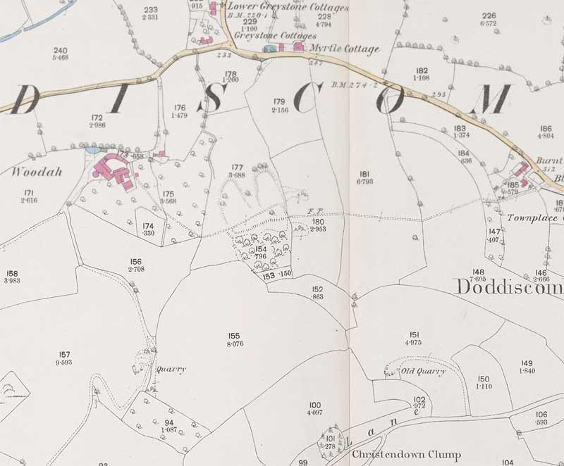
A late 1800s map of the area, with the workings in the middle of the map
It has been suggested in some locally written literature that this was once a road-stone quarry, something I totally disagree with as the rock type, being shale, is unsuitable for this purpose. In any case, the gentleman who owned the land when I was a child, long since deceased, categorically described it as being an old manganese mine, something more recent owners also happened to agree with. The material found on the spoil heaps of other metalliferous mines in the valley tends to be fine gravel and sand, as a result of it having passed through a set of stamps to break up the rock. That isn't the case here, the lumps of shale typically being around the size of a child's fist.
Regarding roadstone quarries, it is possible that some confusion has crept in over the years as higher up on the hill there is a small stone quarry where dolerite was once extracted, although this seems to have been an isolated occurrence in this area, road stone having been extracted on a major scale near Trusham. Something I have yet to resolve though, is the issue of the missing manganese ore. Despite doing a careful search of the spoil heaps, all I could find were small pieces of shale with no trace of mineralisation, which is not what I'd expect. Could these heaps be just the material removed before the ore was exposed? If so, where was the material which was in contact with the ore taken? In Scanniclift, there is evidence of mineralisation on some of the waste, but not here; perhaps I need to re-visit the site and have a better look.

I'll just make mention here (mainly to remind myself) of an odd type of fossil I used to find in some pieces of shale at this site, which was reminiscent of the growth rings in a tree, but the ridges were too elliptical for that; neither were they conchoidal fractures, as shale doesn't break that way and I don't know of any shell that would look like that. My crappy sketch to the left gives a good idea what these things looked like: they occurred on a flat cleaved face of shale and the fossil was composed of ridges in the curved fashion shown, and didn't consist of any fossilised material, it was just the shape in the rock. If I get the chance, I must scour any exposed shale for an example as I've not encountered anything like it before; a palæontologist or museum may well be interested.
Although this is evidently an open working, I believe the miners followed the ore body and continued the excavation underground at a moderate angle for a short distance to the east, and considerably undercut the high rock face to the south, with waste material backfilling some of the open works. Material falling down from the high rock face has since filled in any evidence of underground workings, leaving just the large quarry visible now.
A previous owner did tell me of a muddy area just north-west of the main pit, that he tried to fill with rubble but the mud just kept swallowing up load after load, so he gave up; this sounds suspiciously like the site of an uncapped shaft, something more to look into when I can next arrange a visit.