(self-governing in free association with New Zealand)

| Kermadec Islands (self-governing in free association with New Zealand) |
|
• Raoul Island •
|
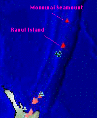 |
KERMADEC ISLANDS
Raoul Island located half-way between New Zealand and Tonga in
the Pacific's Volcanic
"ring of fire" is the Northern most island in the Kermadec Islands Group. It is
a bewitched
Pacific paradise which has capture the imagination of many would-be DX-peditioners
luring some to its shores over the past twenty years. But the island's volcanic core that
vents with alarming frequency resulting in earthquakes and eruptions has sounded a
caution alarm with the New Zealand Government severely restricting the number of
permits that are granted for non-government activities on the island.
Those Dxers who are fortunate enough to receive permission to
land and operate from
Raoul Island are faced with a three to four day journey through the stormy Pacific. The
inclement weather often encountered in this region has adversely affected some recent
expeditions-in one case wrecking the expeditioners' ship leaving them stranded on the
island for several weeks.