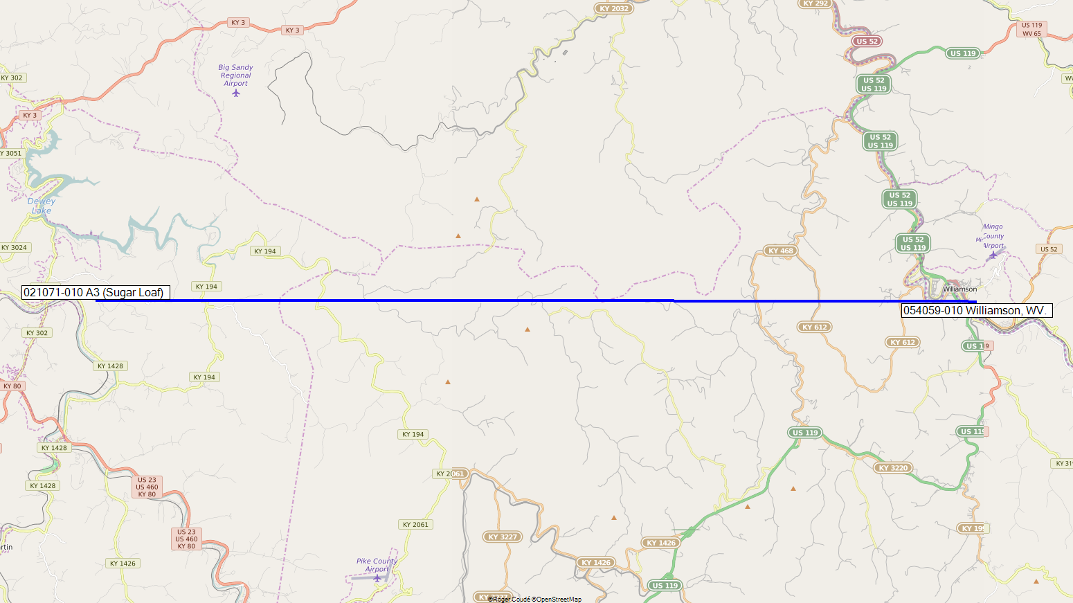
Click on the Link image and Map image to see them larger.
| Latitude | 37� 40'
10.01" 37.66944722� |
N |
| Longitude | 82� 42'
21.80" 82.70605556� |
W |
| Ground elevation | 1386.000 442.453 |
Ft m |
| Antenna height | 149.638 45.000 |
Ft m |
| Azimuth | 260.73 TN | 267.65 MG | � |
| Tilt | -5.61 | � |
| Latitude | 37� 40'
08.96" 37.66915555� |
N |
| Longitude | 82� 16'
08.42" 82.26900556 |
W |
| Ground elevation | 1246.000 379.781 |
Ft m |
| Antenna height | 375.000 114.300 |
Ft m |
| Azimuth | 270.18 TN | 277.40 MG | � |
| Tilt | -0.18 | � |
| TX power | 30.00 | dBm |
| TX line loss | 0.00 | dB |
| TX antenna gain | 27.00 | dBi |
| RX antenna gain | 27.00 | dBi |
| RX line loss | 0.00 | dB |
| RX sensitivity | -113.02 | dBm |
| Free space loss | 139.41 | dB |
| Obstuction loss | -0.22 | dB |
| Forest loss | 1.00 | dB |
| Urban loss | 0.00 | dB |
| Statistical loss | 30.14 | dB |
| Total path loss | 170.33 | dB |
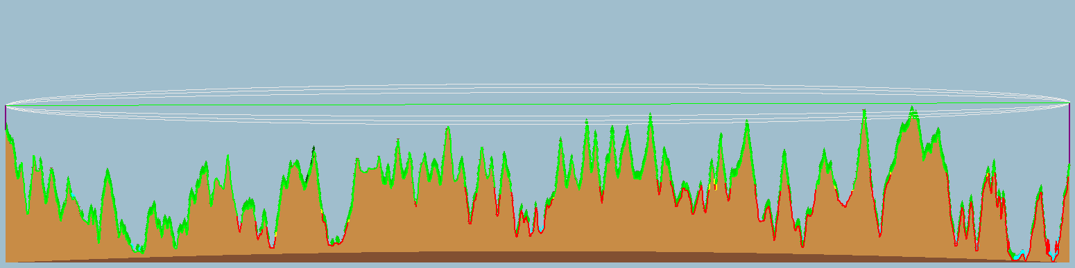
| Distance | 23.903 38.468 |
Mi km |
| Precision | 62.992 19.200 |
Ft m |
| Frequency | 5825.000 | Mcs. |
| Equivalent Isotropically Radiated Power | 501.187 | W |
| System gain | 197.02 | dB |
| Required reliability | 99.000 | % |
| Received Signal | -86.33 | dBm |
| Received Signal | 10.80 | μV |
| Fade Margin | 26.69 | dB |