KB1SYV

NWS Forcast and Predictions

Home


NOAA Weather Radio
CT Weather Radio Forecast

United States UV Index Forcast

UV Index forecast map

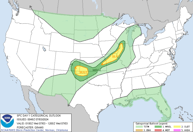
Today's Convective Outlook

SPC Day1 0100Z Outlook Categorical
SPC Day1 0100Z Outlook Categorical Legend

Click on map for detailed information


Tomorrow's Convective Outlook

SPC Day 2 1730Z Outlook Categorical Outlook
SPC Day 2 1730Z Outlook Categorical Legend

Click on map for detailed information


NWS/SPC Watch, Warning, Advisory Display

NWS/SPC Watch, Warning, Advisory Map

Click on map for detailed information

Convective/Tropical Weather Flooding Winter Weather Non-Precipitation
Tornado Watch
Tornado Warning
Severe Thunderstorm Watch
Severe Thunderstorm Warning
Hurricane Watch
Hurricane Warning
Tropical Storm Watch
Tropical Storm Warning
Flash Flood Watch
Flash Flood Warning
Coastal/Flood Watch
Coastal/Flood Warning
Small Stream Flood Advisory
Blizzard Warning
Winter Storm Watch
Winter Storm Warning
Snow Advisory
Freezing Rain Advisory
Ice Storm Warning
Winter Weather Advisory
High Wind Warning or Advisory


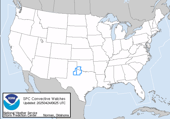
Current Convective Watches

Valid WW Image
WW Graphics Legend
Click on map for detailed information


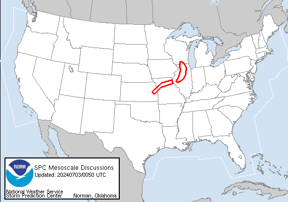
Current Mesoscale Discussions

Valid MD Image
MD Legend Image
Click on map for detailed information


GOES Eastern US SECTOR Water Vapor Image

Courtesy of NOAA Satellite and Information Service
Current Goes east eastern us water vapor image
Eastern Conus Sector (Water Vapor Channel)
GIFS/WCWV.JPG

GOES Western US SECTOR Water Vapor Image

Courtesy of NOAA Satellite and Information Service
Current Goes west western us water vapor image
Western Conus Sector (Water Vapor Channel)


USPLN Current Lightning Data

Map and data courtesy of United States Precision Lightning Network (www.uspln.com)


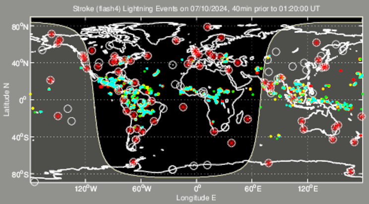
Lightning Activity For The Earth

Map and data courtesy of World Wide Lightning Location Network (www.wwlln.net)
WWLL Earth map
Lightning stroke positions are shown as coloured dots which "cool down" from blue for the most recent (occurring within the last 10 min)
through green and yellow to red for the oldest (30-40 minutes earlier). Red asterisks in white circles are active WWLL lightning
sensor locations. The terminator (day-night boundary) is shown, with the daylit section of the globe in grey.