
Wichita Mountains Wildlife Refuge
SOTA Expedition September 6-7, 2013
For the 2013 North America SOTA Weekend, I decided to activate 4 peaks in the Wichita Mountains. I made it to the first summit, but ran out of water on the way to the second. By the time I got back to the car, I was too dehydrated and tired to try to activate another one.
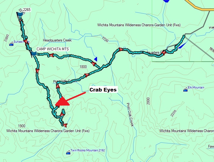
I started hiking from the sunset picnic area. There are two bridges from the picnic area. The one at the middle goes toward Elk Mountain, and the one at the end of the road goes toward the camping area. I camped right at the base of Sunset peak. The elk started bugling at sunset and kept it up all night. At first light, I started hiking toward the first summit. The approach was fairly straightforward up the cut between sunset peak and the peak to the east. Once over the ridge it is an easy walk to the rocks at the summit. See my video on YouTube to get an idea of the geography of the summit. I activated the summit using my Yaesu 857D, and my 40m wire dipole mounted on a 12’ crappie fishing pole.
I packed up my equipment and started hiking towards the Crab Eyes. The hike down and across the valley wasn’t very difficult, but once I started up the slope near crab yes, the going became very treacherous. There is a bolted climbing route on the back side of Crab Eyes and a trail which leads all the way back to the parking lot. It would have been easier to climb the trail to the east of Crab Eyes, which is where I came down. I got over the ridge behind Crab Eyes and then ran out of water in my camel back at the valley within sight of Twin Rocks Mountain. I always keep a quart of water in my pack in case of this situation, so I knew I had that much water to get back to the car. I backtracked over the ridge to Crab Eyes and followed the climber’s trail back to the parking lot. My quart ran out about ½ mile from the end of the hike. There wasn’t any water at the picnic area, but I found a spigot at the headquarters about ¼ mile down the road.
© 2013, Stephen Denison
Last Updated: September 22, 2013