FIRE IIA
Home
Updates
SCARA
SCAREV
Classified Ad's
Clubs
Computers
DX
Earthquakes
Fun & Misc.
Ham Radio
Links
New Links
Franks'
Packet
Science
Science II
Space
Space II
Virus
America did not invent human rights, Human Rights invented America.
WEATHER
WEATHER II Satellite Images
FIRE
FIRE II (Daily)
FIRE MAPS
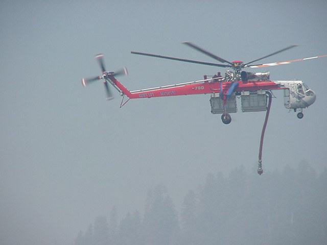
Photo by Berry, N6OGE
NATIONAL FIRE NEWS
KTLV-10 CAMERAS
MT. BALDY SKYCAM
MT. ASHLAND SKYCAM
KLAMATH FALLS SKYCAM
YREKA, CA. SKYCAM
MEDFORD TOWER CAM
National Interagency Fire Center: Fire Danger Map
Fires Burning Nation Wide
----- CALIFORNIA -----
----- OREGON -----
Current Pacific Northwest Fires Map
RETURN TO TOP OF PAGE
copyright © 2000, 2001, 2002 & 2003 by Frank Cross. All rights are reserved


